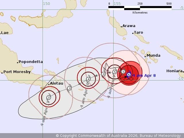
Severe Cyclone Maila has intensified into a Category 5 cyclone in the Solomon Seas.
According to the Pacifica Tropical Cyclone Updates, Cyclone Maila (31P) becomes the first Category 5 (Australian scale) severe tropical cyclone on record in the Solomon Sea as it continues to intensify.
Current storm information as of 1800 UTC:
• Position: 9.6°S 156.1°E
• Movement: Nearly stationary
• Intensity: 115 knots (215 km/h), gusting to 160 knots (295 km/h)
• Intensity category: 5
• Central pressure: 924 hPa
Trend:
• Some fluctuations in intensity are likely during the next 24 hours, but Maila is expected to remain an extremely dangerous severe tropical cyclone during the next few days.
Hazards affecting land:
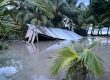
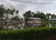
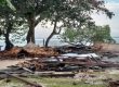
• Maila is producing occasional heavy rainfall and gusty winds over the westernmost Solomon Islands, and these conditions will likely persist for another day or two before Maila begins moving away. In addition, heavy surf and coastal flooding are likely occurring.
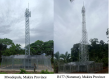
• Maila is expected to pass over the islands of Milne Bay Province in Papua New Guinea on Thursday. Although it will likely be weakening as the environment becomes less conducive, it is likely to produce extremely dangerous hurricane force winds and extremely heavy rainfall in those islands, in addition to heavy to phenomenal surf and coastal flooding. These conditions will likely affect mainland Papua New Guinea, particularly the Alotau area, beginning late Friday night and continuing into Saturday. All preparations to protect life and property should be rushed to completion as soon as possible.
• Interests in the Cape York Peninsula should continue to monitor the progress of Maila.
As of 1:30am Wednesday morning Solomon Islands Meteorological Service confirmed that at 11:00pm Tuesday night, Severe Tropical Cyclone Maila was located about 165 kilometres southwest of Rendova Island.
The cyclone, with a central pressure of 936 hectopascals, is moving slowly northwest in the Solomon Sea while strengthening.
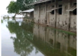
Authorities warn that gale force winds between 63 and 87 kilometres per hour are expected across Western Province, accompanied by very rough seas and swells of up to 6 metres. Coastal flooding, heavy rainfall, and thunderstorms are also forecast.
Other provinces are also expected to experience deteriorating conditions. Winds of up to 61 kilometres per hour are forecast for Choiseul and Isabel provinces, along with moderate to rough seas and potential coastal flooding. Heavy rain and thunderstorms are expected across the rest of the country.
Officials caution that the severe weather could trigger landslides and flooding, particularly in low-lying areas and communities near rivers and steep slopes.
Sea travellers have been urged to take extra precautions due to dangerous sea conditions and reduced visibility. Motorists are also advised to exercise extreme caution and avoid crossing flooded rivers and streams.
Residents are strongly encouraged to take necessary safety measures as the cyclone poses serious risks to lives and property.
The next cyclone warning will be issued at 7:30am.