As the world marks World Environment Day on June 5, the United Nations Development Programme in Solomon Islands as part of the Pacific MCO contributes widely to a more sustainable environment using natural resources sustainably and increasing resilience to climate change and disasters.
Among our programming, today we proudly shines a spotlight on a transformative, community-led initiative in Solomon Islands: the Mai-Maasina Green Belt.
Anchored in Waihau and spanning thirty Are’are, Kwaio and Small Malaita tribal communities in Malaita Province, this innovative model blends indigenous knowledge, conservation technology, and sustainable livelihoods to protect biodiversity and support resilient ecosystems looking after the environment in an inspiring way.
Under the Mai-Maasina Green Belt network, a program is setting a new precedent for community-driven conservation by strengthening traditional governance systems and promoting protected area programming.
At the heart of this progress is the MAPEO Application Tool—a digital solution adapted to the local context.
Through targeted training and community ownership, the project has empowered local rangers to lead biodiversity monitoring and geospatial mapping in their tribal lands.
“The success of this initiative lies in the strength and leadership of our communities working in partnership. This program is proof that conservation is most effective when local people are the stewards of their own natural resources,” said Dr. Edgar Pollard, MMGB Coordinator. “By integrating traditional knowledge with technology like MAPEO, we’re not only protecting our environment—we’re reclaiming our identity and securing our future.”
Key Activities and Achievements:
- Training of community rangers from 8 conservation sites—Waihau, Hi’i, Wa’ariai, Horoia, Aparoro, Ahetaha, Raripaina and Kira—on using the MAPEO geospatial tool via smartphones.
- Translation of MAPEO variables into Are’Are dialects, ensuring accessibility and cultural relevance for rangers across all communities.
- Over 19 rangers trained in comprehensive data collection, mapping vital ecological and cultural features including flora and fauna, ancestral graves, cultural sites, and settlements.
- Four months of data collection (March–July 2024) successfully completed by rangers, with outputs contributing to potential future management and land use planning strategies.
- MAPEO evaluation training conducted through surveys, group discussions, and hands-on demonstrations to strengthen rangers’ understanding and application of geospatial data.
- Ripple effects of the project already visible, with neighboring conservation sites expressing strong interest in adopting MAPEO for their own resource management.
The Mai-Maasina Green Belt is a testament to the power of local action for global impact. By nurturing environmental stewardship at the grassroots level, the project supports Solomon Islands’ broader climate and biodiversity commitments, and aligns with global Sustainable Development Goals (SDGs) on climate action, life on land, and sustainable communities.
UNDP remains committed to supporting community-led innovations like this that prioritize indigenous knowledge, environmental protection, and local livelihoods in tandem.
The Small Grants Programme (SGP) is a corporate programme of the Global Environment Facility (GEF) implemented by the United Nations Development Programme (UNDP) since 1992.
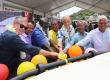
Photo caption 1: Rangers trying the new app on their phones during a training session
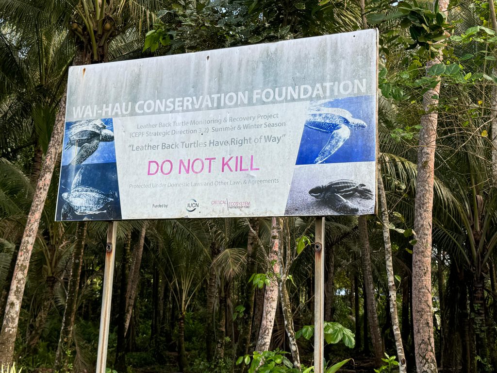
Photo caption 2: Program signboard