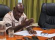
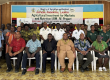
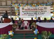
The Solomon Islands National Statistics Office, SINSO, has concluded a Geographic Information System, GIS, training on Friday 3rd October 2025 conducted by the Pacific Community, SPC in Honiara.
The five-day training aimed to provide the statisticians with the necessary skills to confidently and more efficiently work on their statistical geographic framework updates, map preparation, planning, and CAPI (Computer Assisted Personal Interviewing) setup.
It also aimed to provide the following;
- To organise and streamline the workflow of GIS work for the coming census.
- To mix GIS training with direct technical assistance, demonstrating the various phases of work and how to perform them in a cost-efficient manner to meet census timelines.
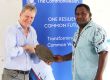
- To strengthen the relationship between SDD and the GIS officers at SINSO through these in-person activities, thereby enhancing the ongoing technical support provided through the GIS mentoring programme.
- To integrate SINSO into SDD’s proven hybrid mode l of support, which combines intensive, in-person training with continuous, long-term mentorship, for better planning and execution of critical GIS work required for their upcoming censuses.
Statistician Wheatley Bea from the Census and Survey Unit said he learnt about the creation of spatial maps which can be used in NSO surveys in regards to assisting in data collection on various parts on the country.
“It will provide visualization on map analysis which can help informed geographically decision making of survey projects for the government and even NGOs.”
Mr Bea adds the training also enhances the NSO staff capacity to support other stakeholders in cartography.
Assistant statistician Desmond Papage also from the Census and Survey Unit said he is grateful for the training and has gained some very useful knowledge and skills.
“Before I had limited knowledge on how to create maps, now I know how to create maps using excel and the GIS software. I’ve learnt the different colours to use when I want to highlight a particular information. For example, red is used in disaster areas to indicate danger zones.
“I am eager to learn more and become well versed with the GIS software. I believe using maps in our dissemination reports would be really great in the future.”
According to a concept note about the training by SPC, following a successful GIS training in Fiji and Samoa last year, they have identified Solomon Islands, as one of the priority countries for this year. This is a strategic choice, as Solomon Islands National Statistics Office (SINSO) actively preparing for their upcoming census.
The SPC is conducting a similar training for Vanuatu next.
- SINSO Press